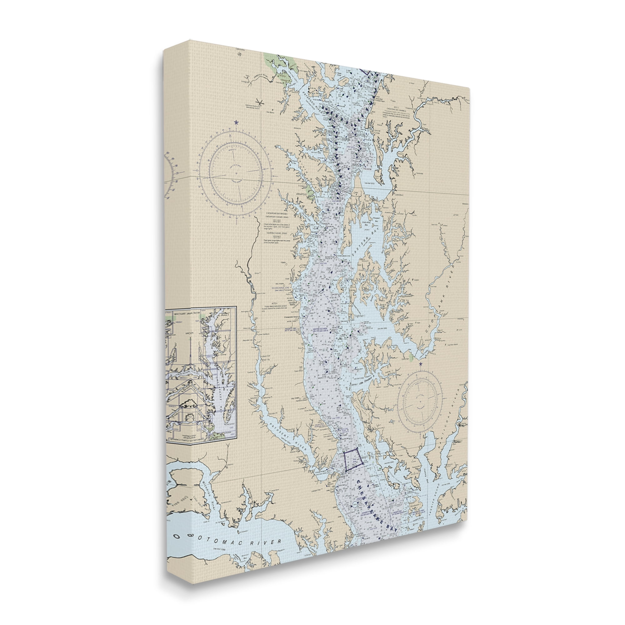
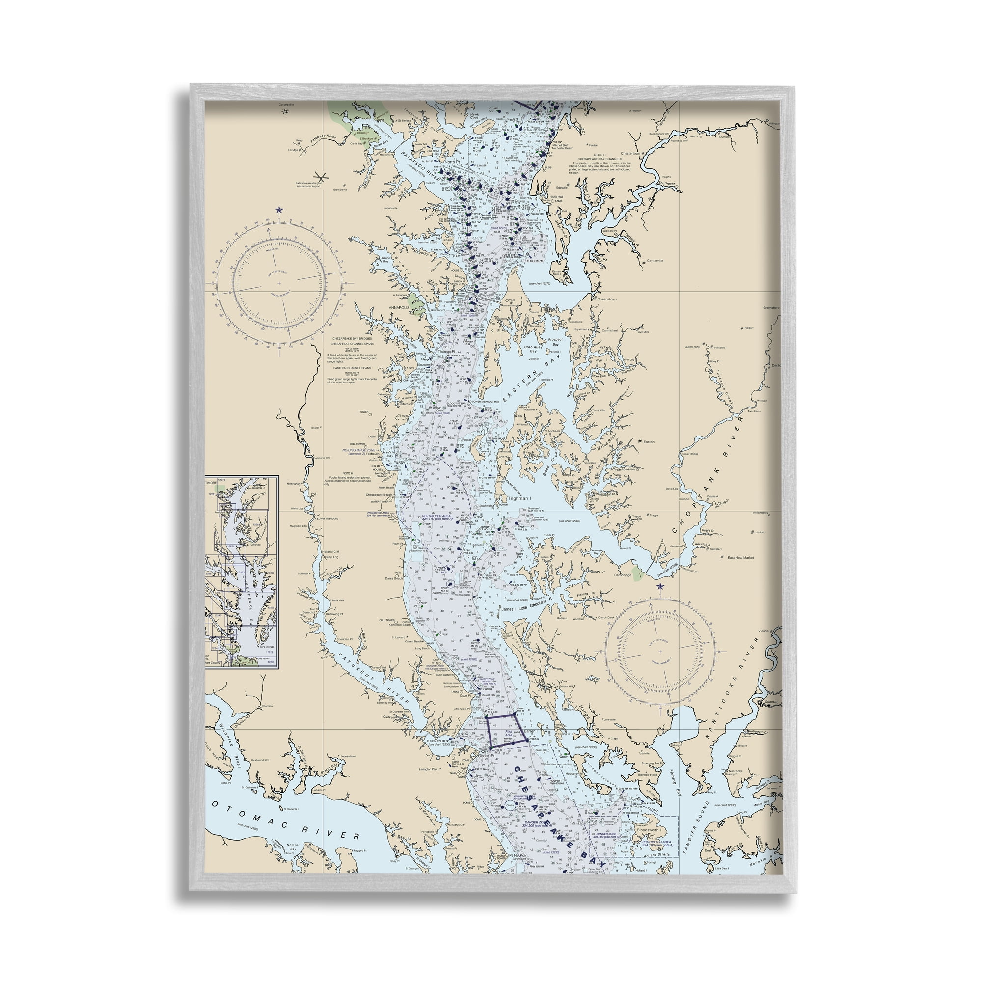
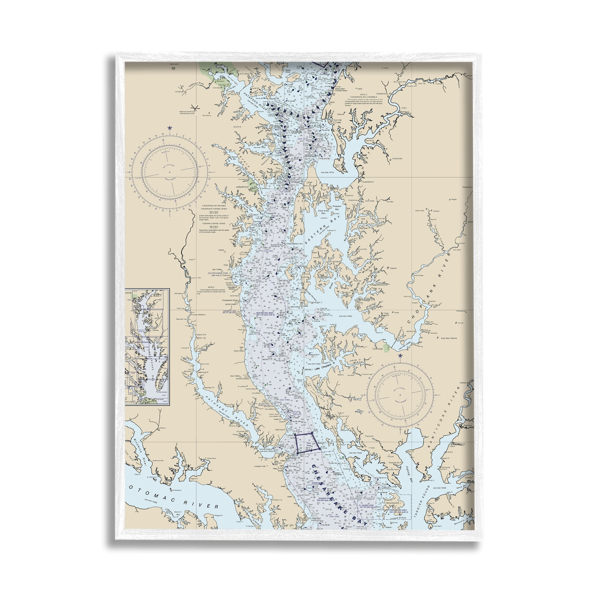
Beige and Blue Coastal Map Canvas Print, 30" x 40"
Colors:
Prices updated 3 days ago

Walmart
Lowest Price

Wayfair
Description
Elevate your space with this stunning coastal map canvas print. Featuring a beige and blue design, it comes ready to hang and is sure to be the focal point of any room. Crafted with high-quality materials, this piece adds a touch of nautical charm to your decor.
Specifications


Related Products


Similar Products
Chesapeake Bay, NOAA Wall Art | 18" X 24" | Artwork And Map Printed On Wood Slats For Unique Pallet Style Map Home Décor | Ready To Hang & Fully
Amazon.com
Stupell Industries Potomac River Chesapeake Bay Coastal Map Beige, Designed By Daphne Polselli Canvas Wall Art, Tan
Amazon.com
Historic Map - A Map Of The Chesapeake Bay :Land Of Pleasant Living, 1959, Vintage Wall Art - 30in X 24in
Amazon.com
Chesapeake Bay Head, Aberdeen, Havre De Grace, Charlestown, Betterton, Maryland - Nautical Map / Chart - Printed On Canvas, Acrylic, Metal
Etsy
Handmade And Framed Chesapeake Bay Maryland, Delaware, Virginia Layered 3D Nautical Bathymetric Wood Map
Etsy
Chesapeake Bay, Maryland Virginia Map | Engraved Wood Coastal Chart Wall Art Sign, Beach House Home Decor Nautical Print, Personalized Gift
Etsy
Sea & Soul Chesapeake Bay Nautical Wall Art | Coastal Décor 3D Wood Map 13-In X 16-In | Nautical Wood Chart | Lake Art | Handcrafted In The USA (
Amazon.com
Chesapeake Bay Map Wood 7 Layer Map Wood Bathymatric Map Lake, River Map, Laser Engraved Wall Art, Housewarming Gift
Etsy
Old Chesapeake Bay Map, Large Framed Art, Vintage Map, Nautical Decor, Extra Large, Above Bed Decor, Bedroom Art, Antique Map
Etsy
3D Chesapeake Bay Wooden Map | Custom Laser-Etched Nautical Map Of Chesapeake Bay | Wedding Gift - Christmas Gift
Etsy
Chesapeake Bay Map Style Print | Beach House Decor | Travel Map | Kids Decor | Home Town Art | Hand Painted Art | Wall Art | Eastern Shore
Etsy
Corsica River Map, Chesapeake Bay Map, Chester River Map, River Map, Custom River Map, 3D Wood Map, Nautical Decor, River Decor, River Gift
Etsy
Stupell Industries Chesapeake Bay Water Flow Map Coastal Cartography, Designed By Daphne Polselli Gray Framed Wall Art, Tan
Amazon.com
Chesapeake Bay-Patuxent River, 3D Map | Custom Nautical Wood Map, Cabin Decor, Beach House Decor, 3D Nautical Chart, Laser-Cut Map, Maryland
Etsy