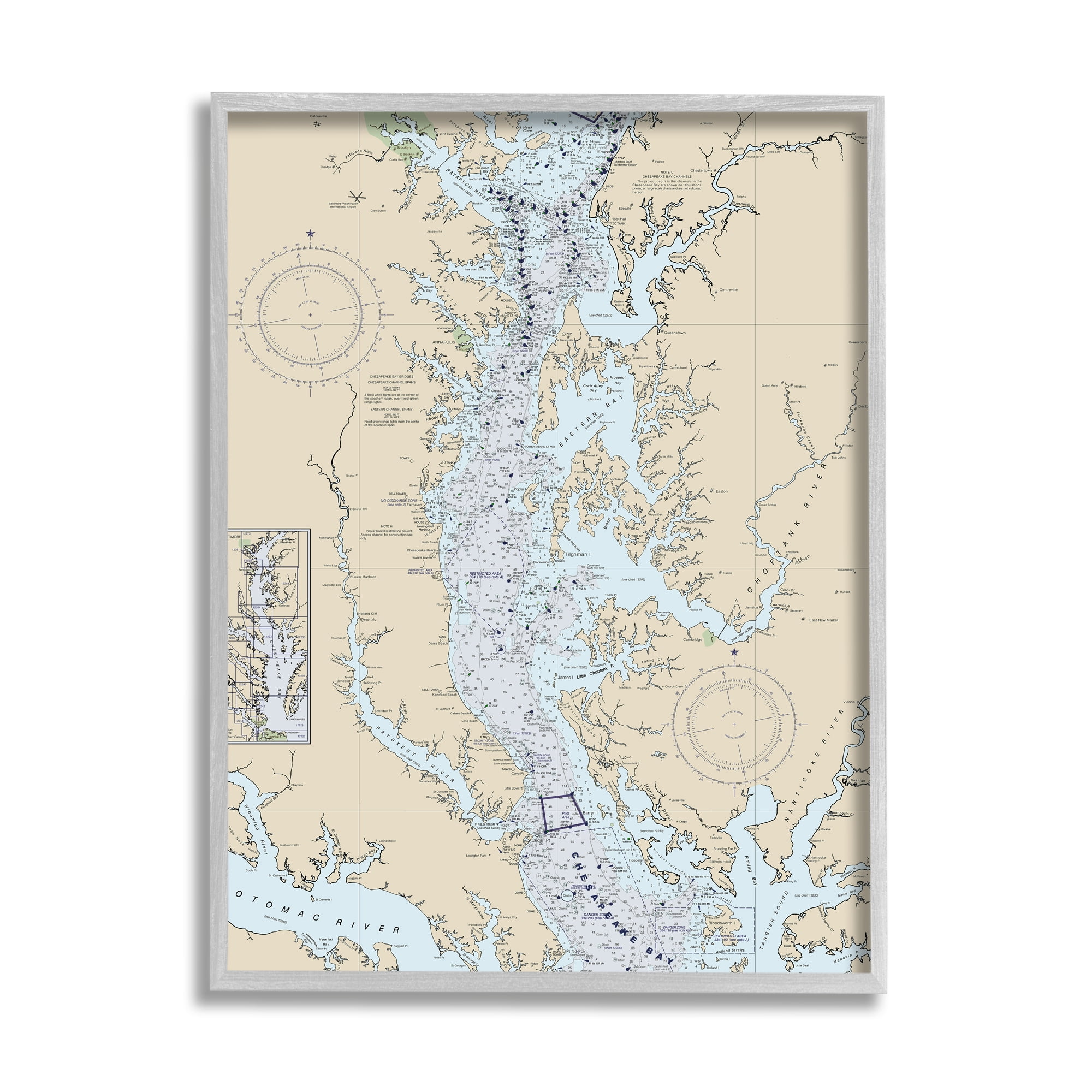


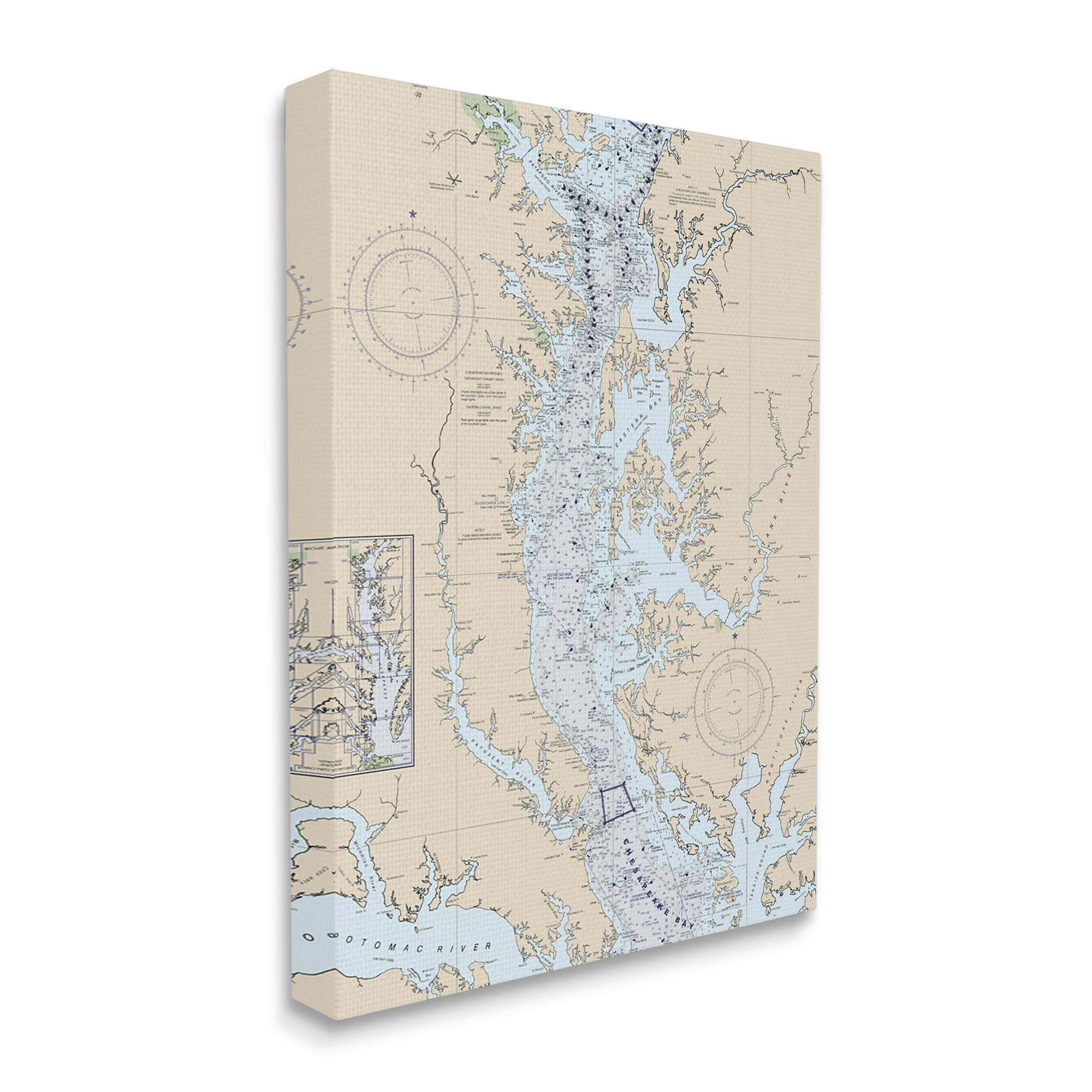
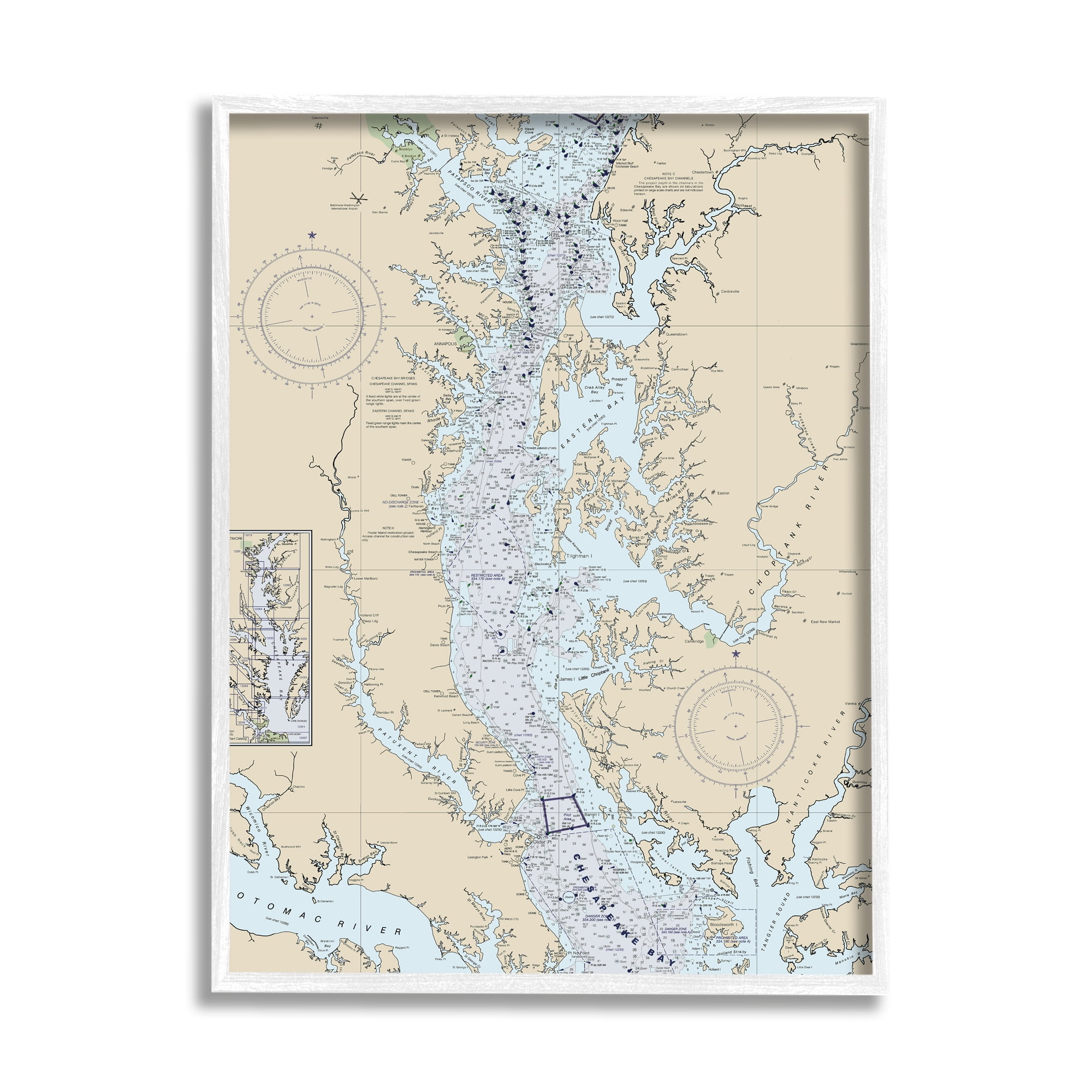
Potomac River Chesapeake Bay Coastal Map Beige Blue Framed Print
Colors:
Prices updated 3 days ago

Bed Bath & Beyond
Lowest Price

Walmart

Amazon
Description
Enhance your space with this stunning coastal map of the Potomac River and Chesapeake Bay. The textured artwork, framed in a gray wood grain frame, adds depth and dimension to any room. Ready to hang and perfect for making a statement.
Specifications
Other Variants


Similar Products
Historic Map : Nautical Chart The Chesapeake Bay And Delaware Bay, Fielding Lucas, 1852, Vintage Wall Dor : 31in X 44in
Amazon.com
Sea & Soul Chesapeake Bay Nautical Wall Art | Coastal Décor 3D Wood Map 13-In X 16-In | Nautical Wood Chart | Lake Art | Handcrafted In The USA (
Amazon.com
Stupell Industries Chesapeake Bay Water Flow Map Coastal Cartography, 16 X 20, Designed By Daphne Polselli
Walmart
Chesapeake Bay | Nautical Chart | Framed Print 24' H X 17" W Black/Brown/Graypaper
Wayfair
Sealake Products The Original Chesapeake Bay Chart: Harve De Grace To Norfolk (Paper)
Amazon.com
Stupell Industries Potomac River Chesapeake Bay Coastal Map Beige Blue, 16 X 20, Designed By Daphne Polselli
Walmart
Pamlico Sound Western Part | Nautical Chart | Framed Print 24' H X 19" W Black/Blue/Brown/Graypaper
Wayfair
Chesapeake Bay Pocomoke And Tangier Sounds | Nautical Chart | Framed Print 24.0 H X 17.0 W X 1.0 D In Brown/Graypaper
Wayfair
Lake Michigan, Muskegon Lake And Harbor | Nautical Chart | Framed Print 24.0 H X 16.0 W X 1.0 D In Blue/Graypaper
Wayfair
Chesapeake Bay Potomac River To Piney Point | Nautical Chart | Framed Print 24' H X 18" W Blue/Graypaper
Wayfair
Chesapeake Bay Entrance | Nautical Chart | Framed Print 36' H X 29" W Whitepaper
Wayfair
Mattawoman Creek To Georgetown | Nautical Chart | Framed Print 24.0 H X 17.0 W X 1.0 D In Black/Graypaper
Wayfair
Intracoastal Waterway East Bay To West Bay | Nautical Chart | Framed Print 36' H X 24" W Whitepaper
Wayfair
Lake Huron, Detour Passage To Munuscong Lake | Nautical Chart | Framed Print 24.0 H X 18.0 W X 1.0 D In Black/Blue/Brown/Graypaper
Wayfair
Intracoastal Waterway Miami To Elliott Key | Nautical Chart | Framed Print 15' H X 24" W Blue/Gray/Whitepaper
Wayfair
St. Johns River Dunns Creek To Lake Dexter | Nautical Chart | Framed Print 17.0 H X 24.0 W X 1.0 D In Blue/Brown/Graypaper
Wayfair